Homes, condos and land for sale and rent in Menlo Park, CA
Menlo Park had 32,026 inhabitants according to the 2010 United States Census.
In 1863, the San Francisco and San Jose Rail Road named a nearby station “Menlo Park” after the sign. The 1867 station building still stands on the platform of the current Caltrain station, used by the local Chamber of Commerce. The town of Menlo Park grew up around this station, becoming a popular home for San Francisco businessmen.
A post office arrived in 1870, and the city was incorporated in 1874. The original arch which gave its name to the stations and ultimately the city survived until 1922, when it was destroyed in an automobile accident. The origin of the name of Menlo Park, California (ca 1850) pre-dates any work done by Thomas Edison (ca 1876) in Menlo Park, New Jersey.
The normal annual precipitation is 20.56 inches (52.22 cm). The most rainfall in one month was 12.42 inches (31.55 cm) in February 1998. The record 24-hour rainfall of 4.88 inches (12.4 cm) was on October 13, 1962. There are an average of 62.1 days with measurable precipitation. Snow flurries have been observed on rare occasions; there was some minor snow accumulation in May 1935, January 1962, and February 1976.
There were 5,902 people (18.4%) of Hispanic or Latino background, of any race. Among the Hispanic population, 4,303 were of Mexican ancestry.
The Census reported that 31,181 people (97.4% of the population) lived in households, 599 (1.9%) lived in non-institutionalized group quarters, and 246 (0.8%) were institutionalized.
There were 12,347 households, out of which 4,112 (33.3%) had children under the age of 18 living in them, 6,163 (49.9%) were opposite-sex married couples living together, 1,039 (8.4%) had a female householder with no husband present, 371 (3.0%) had a male householder with no wife present. There were 642 (5.2%) unmarried opposite-sex partnerships, and 102 (0.8%) same-sex married couples or partnerships. 3,672 households (29.7%) were made up of individuals and 1,371 (11.1%) had someone living alone who was 65 years of age or older. The average household size was 2.53. There were 7,573 families (61.3% of all households); the average family size was 3.20.
In terms of age 7,805 residents (24.4%) were under the age of 18, 1,817 people (5.7%) aged 18 to 24, 9,563 people (29.9%) aged 25 to 44, 8,263 people (25.8%) aged 45 to 64, and 4,578 people (14.3%) who were 65 years of age or older. The median age was 38.7 years. For every 100 females there were 93.7 males. For every 100 females age 18 and over, there were 91.5 males.
There were 13,085 housing units at an average density of 1,336.6 per square mile (516.1/km²), of which 6,927 (56.1%) were owner-occupied, and 5,420 (43.9%) were occupied by renters. The homeowner vacancy rate was 1.1%; the rental vacancy rate was 5.2%. 18,972 people (59.2% of the population) lived in owner-occupied housing units and 12,209 people (38.1%) lived in rental housing units.
Catholic parochial schools are St. Raymond Catholic Elementary School and Nativity Elementary School. Peninsula School is a private progressive primary school. Trinity School is an Episcopalian elementary school. The German-American International School with about 315 students, K-12, is also in the city.
For higher education, Saint Patrick’s Seminary and University is a Catholic seminary in Menlo Park. Fuller Theological Seminary, an evangelical Christian school, has a branch campus in Menlo Park. Menlo College and Menlo School, which is a prep school, despite their names are in neighboring Atherton.
There are two libraries within the city, the Main branch and the Belle Haven branch. These libraries are part of the Peninsula Library System and share many resources with other nearby libraries.
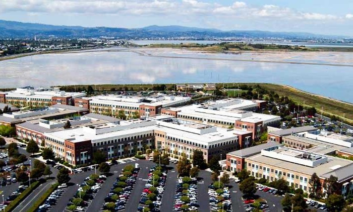
Facebook moved its headquarters to the former campus of Sun Microsystems in Menlo Park in December 2011.
Other cities in San Mateo County
Pacifica Real Estate for sale and rent
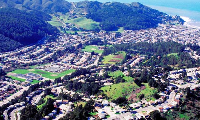
Homes, condos and land for sale and rent in Pacifica, CA Pacifica is a city in San Mateo County, California, on the coast of the Pacific Ocean between San Francisco and Half Moon Bay. The [...]
Menlo Park Real Estate for sale and rent
Homes, condos and land for sale and rent in Menlo Park, CA Menlo Park is a city at the eastern edge of San Mateo County, in the San Francisco Bay Area of California, in the [...]
Redwood City Real Estate for sale and rent
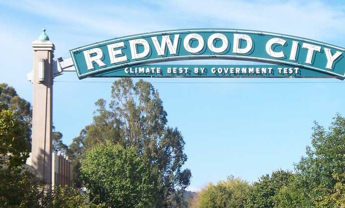
Homes, condos and land for sale and rent in Redwood City, CA Redwood City is a city on the San Francisco Peninsula in Northern California's Bay Area, approximately 27 miles (43 km) south of San [...]
San Mateo Real Estate for sale and rent
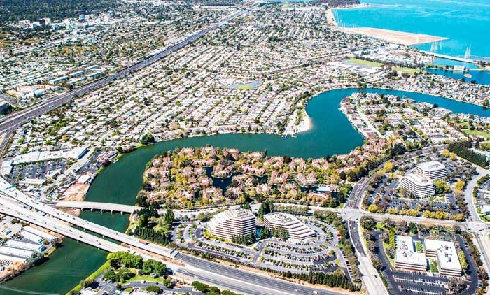
Homes, condos and land for sale and rent in San Mateo, CA San Mateo is a city in San Mateo County, California, in the high-tech enclave of Silicon Valley in the San Francisco Bay Area. [...]